
NEW ORLEANS STREETCAR ARTIFACTS
www.streetcarmike.com
Page created December 11, 2008. Last updated August 29, 2022.
©2008-2022 Michael Strauch. All rights reserved.
Home
Updates
New Orleans
NOPSI
NORTA
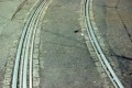
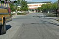
CANAL STREET RIGHT OF WAY:
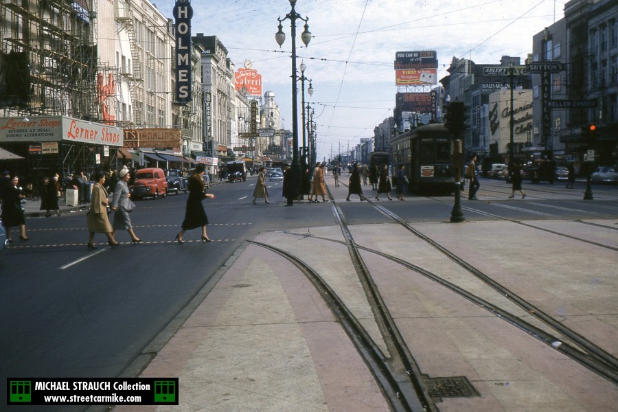
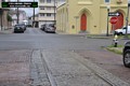
 Canal car 934 outbound at Dauphine St. in 1952. This shot is taken from the former outbound outside track, which was no longer in use since the
replacement of Desire with buses in 1948. There used to be a track from Dauphine that fed into it; the last use of the Dauphine track was as a reroute
from N. Rampart, according to the 1936 route map. One photo added 12/04/14.
Canal car 934 outbound at Dauphine St. in 1952. This shot is taken from the former outbound outside track, which was no longer in use since the
replacement of Desire with buses in 1948. There used to be a track from Dauphine that fed into it; the last use of the Dauphine track was as a reroute
from N. Rampart, according to the 1936 route map. One photo added 12/04/14.
CARONDELET STREET RIGHT OF WAY:
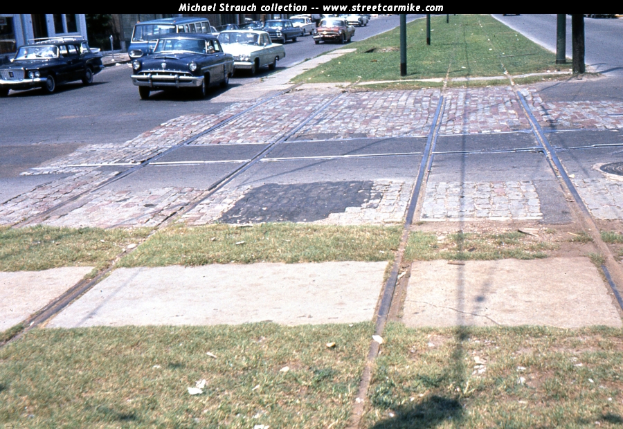
 Crossing Howard Avenue, where the tracks are used for emergency turnbacks of the St. Charles line, is a single track
on Carondelet St. formerly used by the Freret and South Claiborne streetcars. This is an isolated piece of track because the
rest of it was removed after the 1953 conversion of Claiborne. The rails of Howard have been modified to prevent
a streetcar from crossing, an impossibility at this time. Slide from my collection dated August 17, 1962 added 12/11/11.
Crossing Howard Avenue, where the tracks are used for emergency turnbacks of the St. Charles line, is a single track
on Carondelet St. formerly used by the Freret and South Claiborne streetcars. This is an isolated piece of track because the
rest of it was removed after the 1953 conversion of Claiborne. The rails of Howard have been modified to prevent
a streetcar from crossing, an impossibility at this time. Slide from my collection dated August 17, 1962 added 12/11/11.
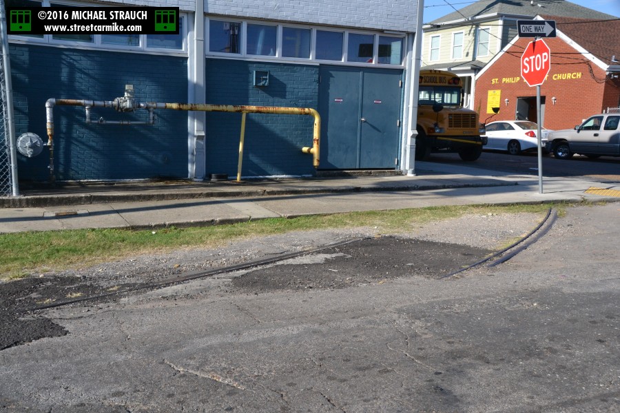
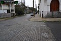
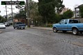
DRYADES ST. RIGHT OF WAY:
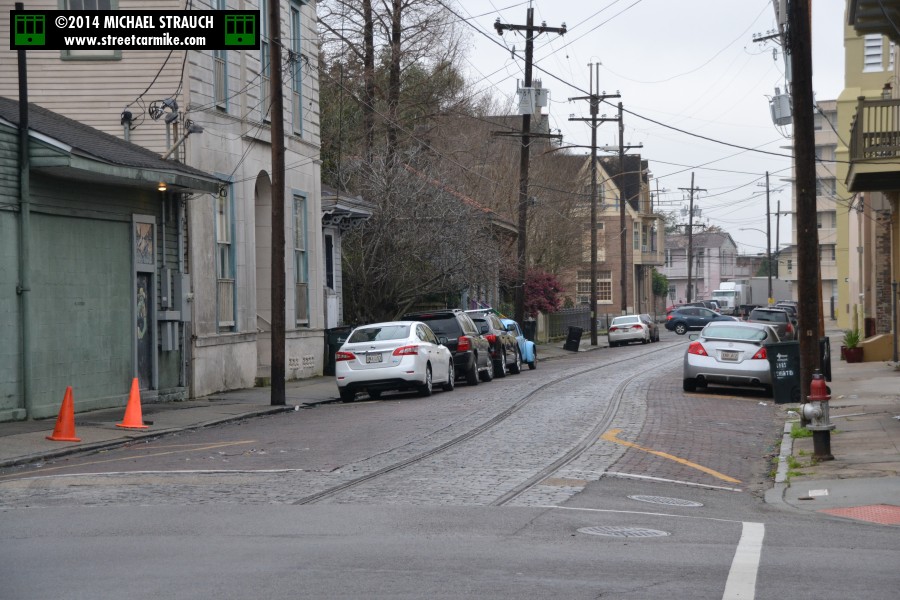
These tracks curve to and from Philip St. one block above Jackson Ave. on what is now Oretha Castle Haley Blvd.,
formerly known as Dryades St.
They carried the last years of operation of the Dryades line. The uptown track jogged barely a quarter block
via Dryades and Philip to Danneel St. The downtown track came down Dryades, but it had to jog outbound on Philip
to get between the upriver and downriver sides of Dryades. Here are some shots of O.C. Haley Blvd. and Philip St.
taken October 5, 2016. Six photos added 10/21/16.
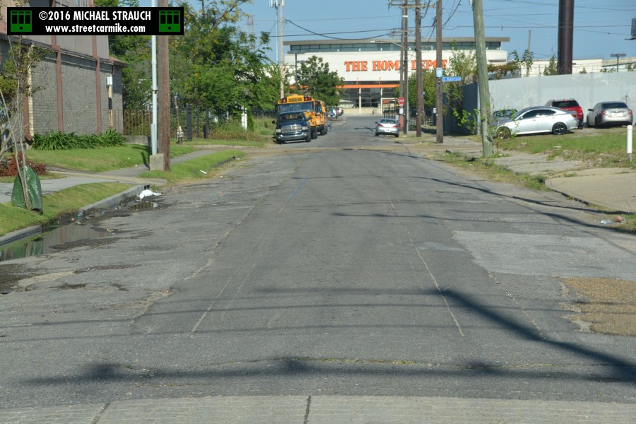
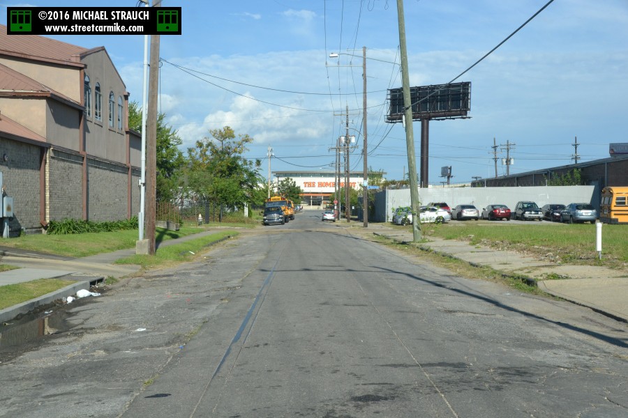
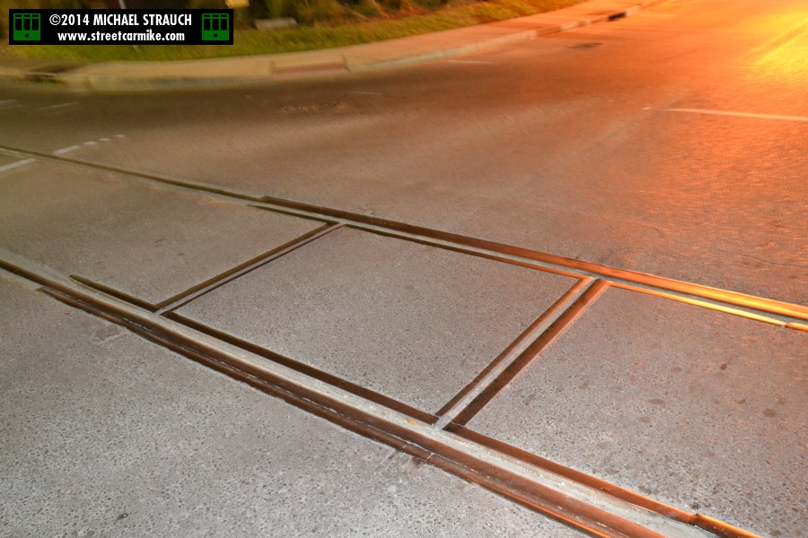
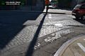
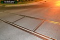
ERATO AND CLIO STREETS RIGHT OF WAY:

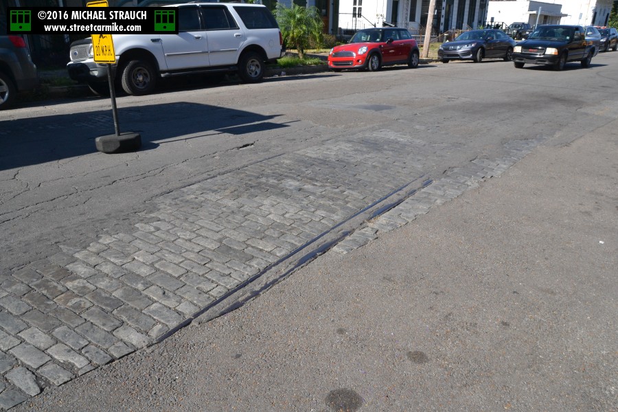
 For three blocks of Erato Street, between Annunciation and Camp, there were on Mardi Gras Day 1981
exposed streetcar tracks. This street carried the Annunciation line (opened in 1867 by Crescent City
R.R. Co.) from 1890 to its consolidation in 1917 with the Laurel line (opened in 1913 by New Orleans Ry. & Light Co.),
then the Laurel line until about 1930. New Orleans Public Service never covered over this
trackage when I photographed it. In fact, Google Maps satellite views still showed these three blocks of Erato containing the tracks as of
October 2010. Two photos added 12/11/08.
For three blocks of Erato Street, between Annunciation and Camp, there were on Mardi Gras Day 1981
exposed streetcar tracks. This street carried the Annunciation line (opened in 1867 by Crescent City
R.R. Co.) from 1890 to its consolidation in 1917 with the Laurel line (opened in 1913 by New Orleans Ry. & Light Co.),
then the Laurel line until about 1930. New Orleans Public Service never covered over this
trackage when I photographed it. In fact, Google Maps satellite views still showed these three blocks of Erato containing the tracks as of
October 2010. Two photos added 12/11/08.
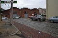
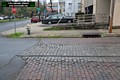
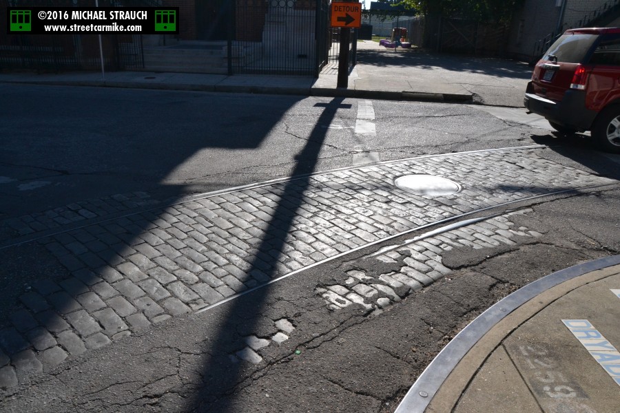
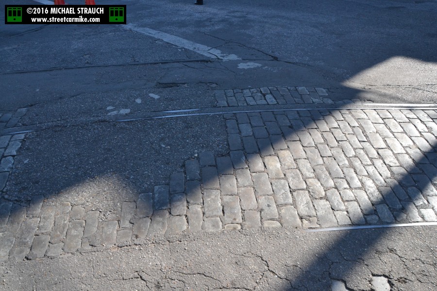
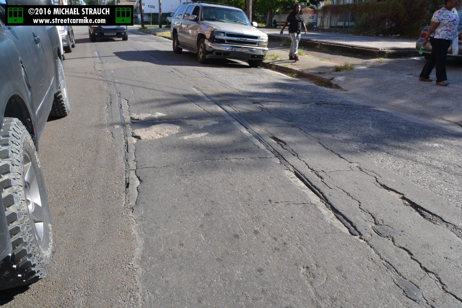
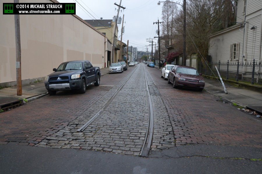
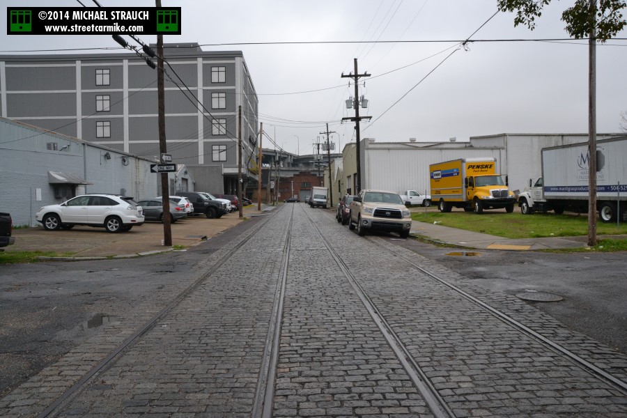
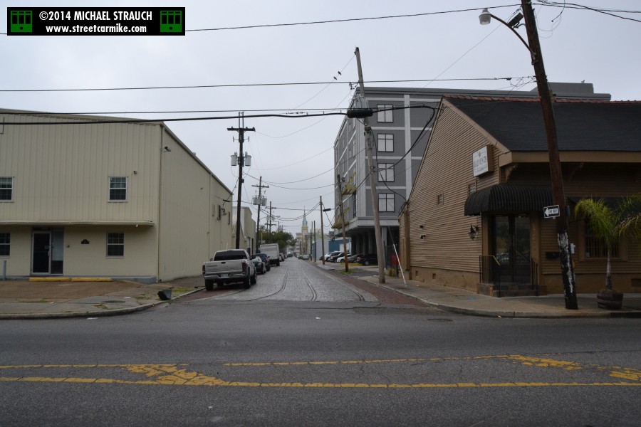
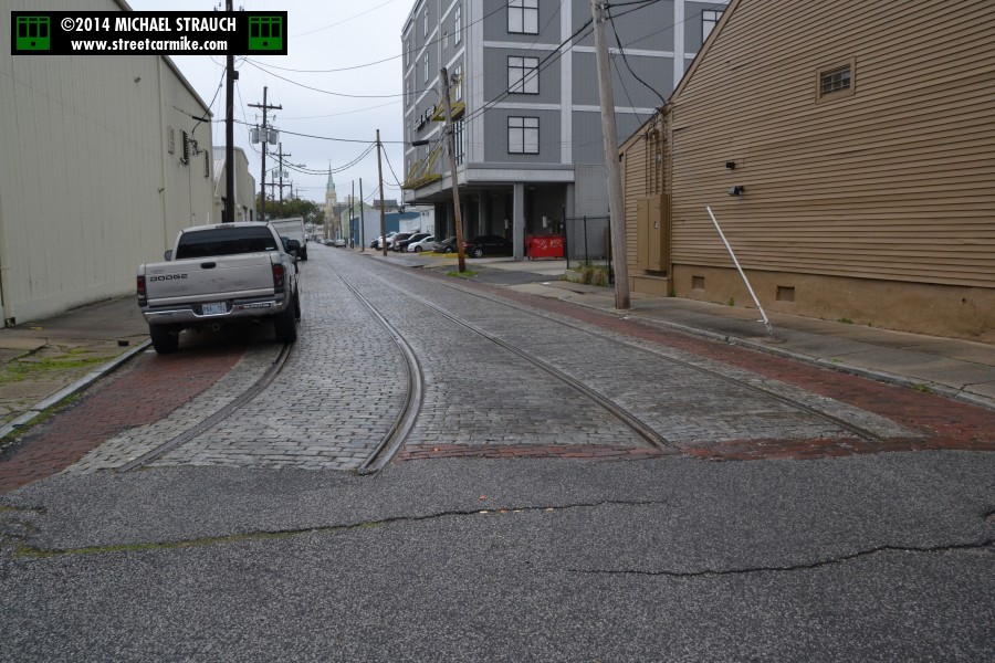
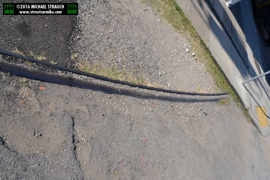
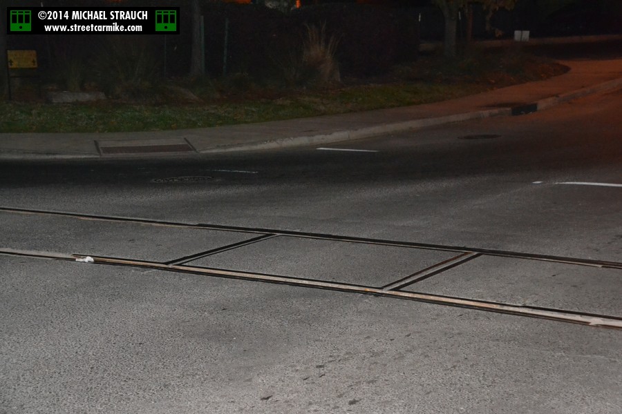
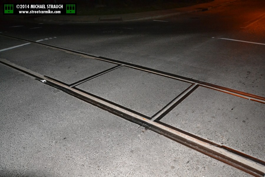
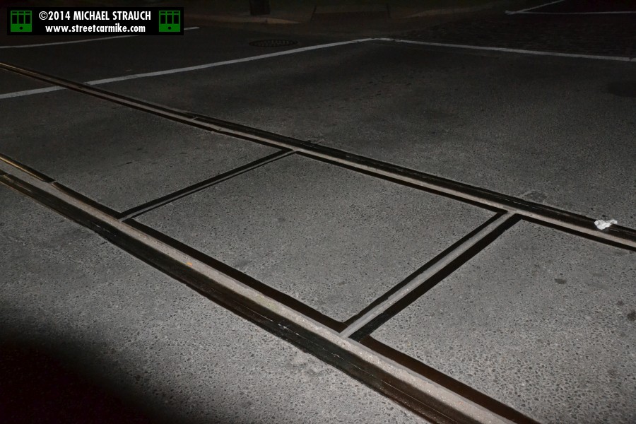
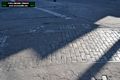
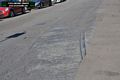
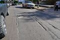
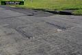
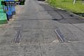
The abandoned tracks on Erato Street were still there on March 6, 2014. You can even see new brick paving on the curbs in sections,
as if the street is being preserved. I also included a photo of the street name; these panels are embedded in many
New Orleans sidewalks at intersections. Seventeen photos added 03/12/14.

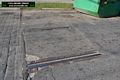
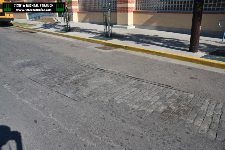
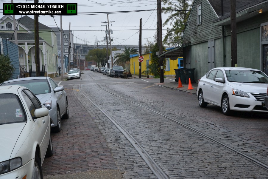
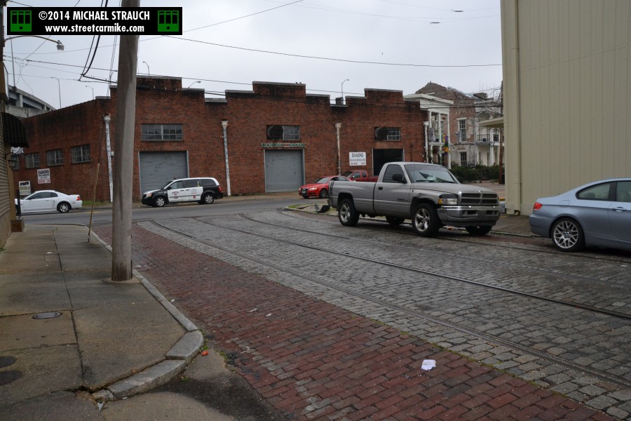
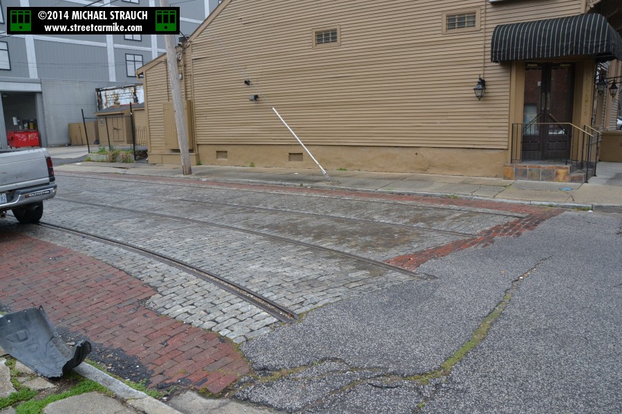
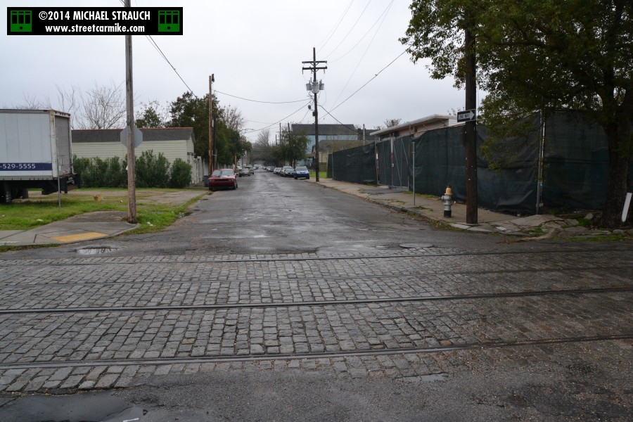
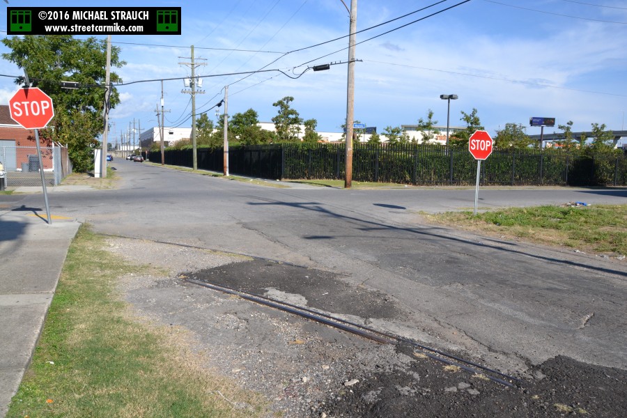
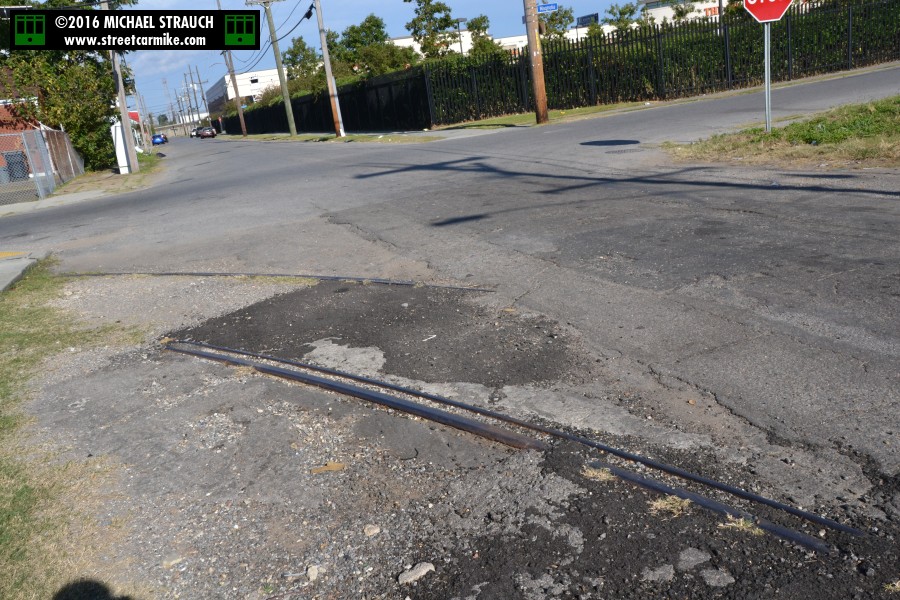
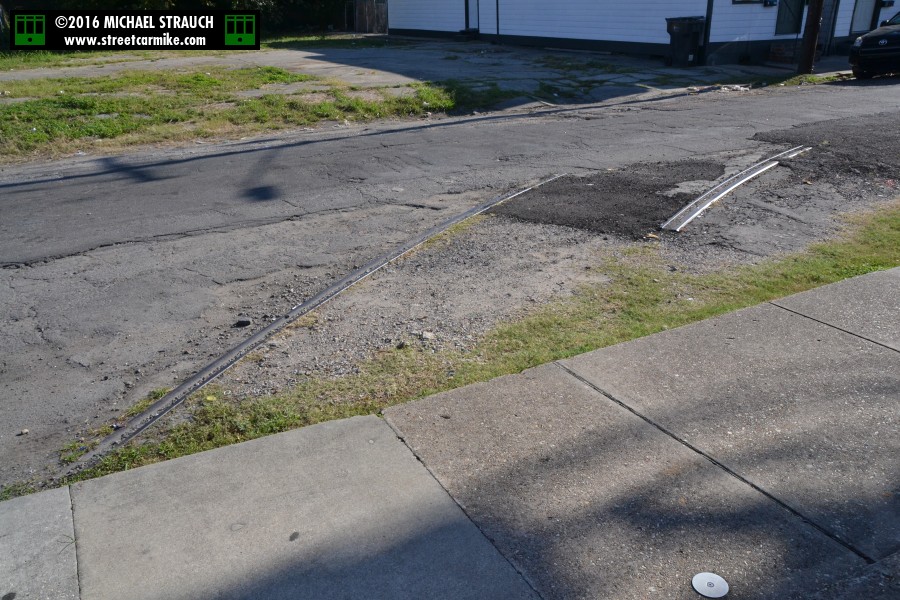
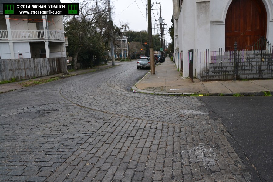
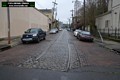
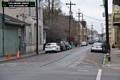
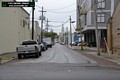
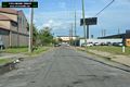
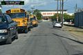
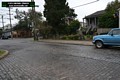
This is a different section of Erato, at Magnolia St. Abandoned tracks appear to curve right into the sidewalk on the
uptown river side of the intersection. This was the route of the Clio streetcar line, which ran out Clio and in Erato in
its various incarnations. Until 1901 the line turned back at Magnolia. During 1901-1932, Clio cars
went at various times to Louisiana Ave., to Maple St. and S. Carrollton Ave. via Freret St. and Broadway, or to S. Broad St.
and Louisiana Ave. via Napoleon Ave. Date on these shots is October 2, 2016. Ten photos added 10/21/16.
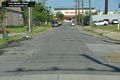

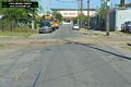

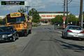
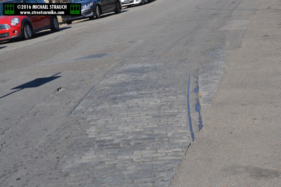
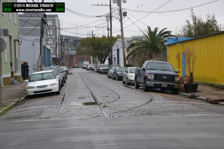
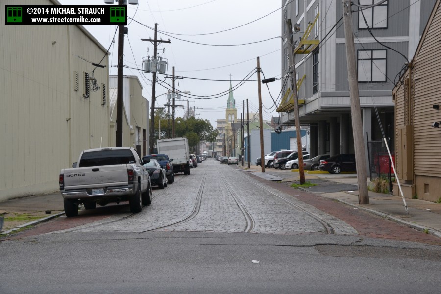
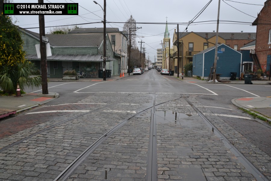
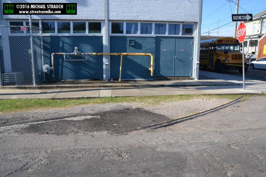
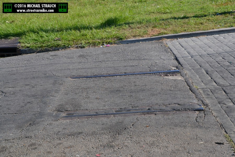
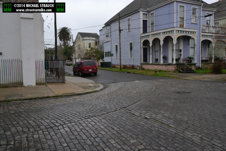
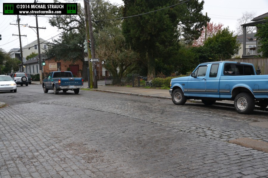
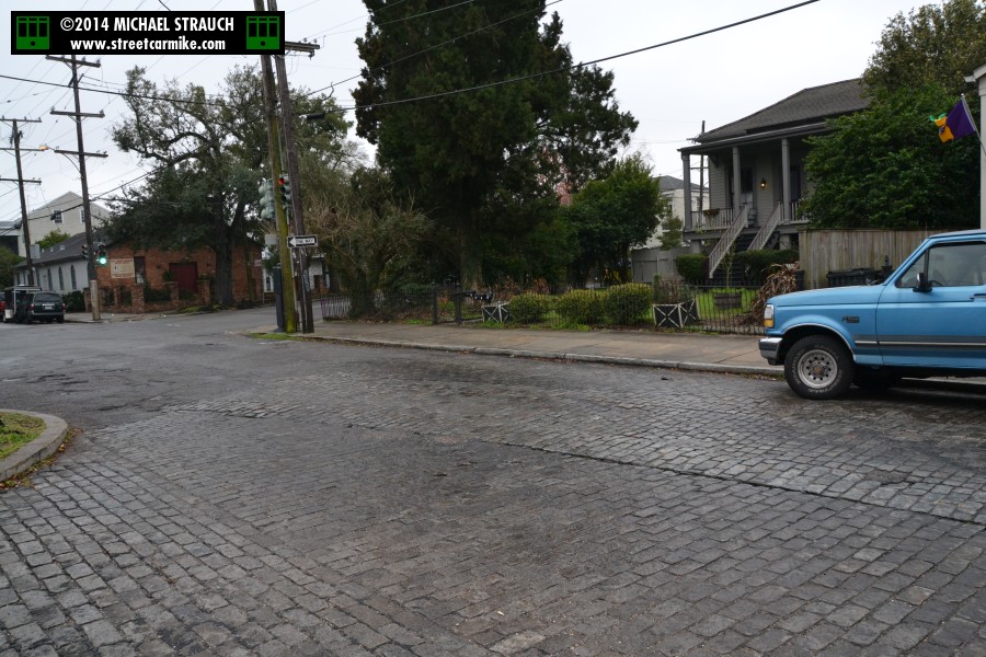
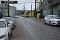
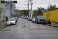
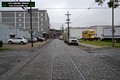
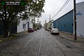
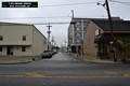
 Also taken on October 2, 2016 are these shots of Clio St. lakebound in the two blocks approaching Magnolia St.
This was the outbound right of way for the Clio line. Eight photos added 10/21/16.
Also taken on October 2, 2016 are these shots of Clio St. lakebound in the two blocks approaching Magnolia St.
This was the outbound right of way for the Clio line. Eight photos added 10/21/16.
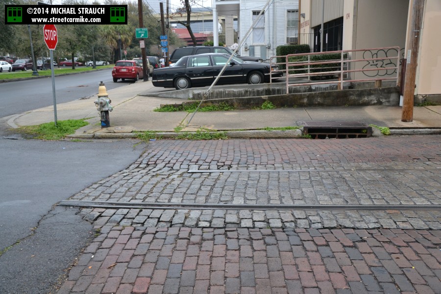
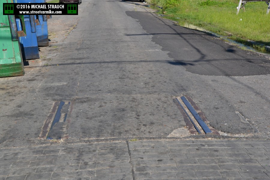
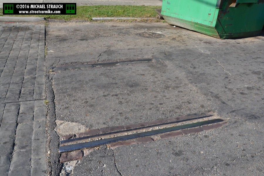
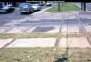
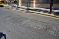
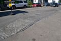
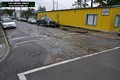
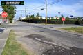
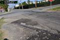
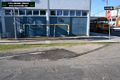
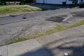
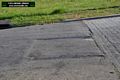
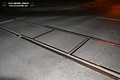
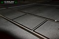
FELICITY STREET RIGHT OF WAY:
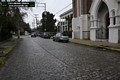
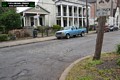
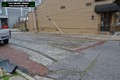
Brick paving marks a former streetcar track area on Felicity St. between Camp and Chestnut Sts. as seen on
March 6, 2014. This was used by the Coliseum line (downtown bound), discontinued May 11, 1929. The rails are gone, but the right-of-way remains.
Six photos added 03/12/14.
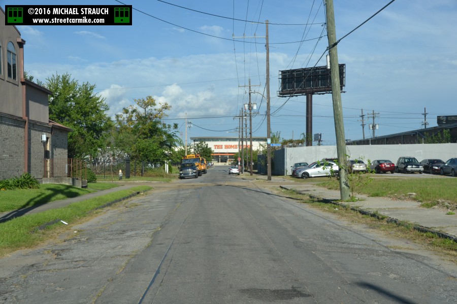
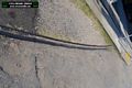
OAK STREET RIGHT OF WAY:
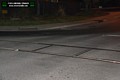
Tracks branch off the main lines on the riverfront and head out Eagle St. to the Sewerage & Water Board facility
(see below for an electric car.) At Eagle and Oak Sts. two rails can be seen perpendicular to the S&WB right-of-way.
These rails are remnants of two lines, the Coliseum line (1903-13) and the Oak Street Shuttle (second phase, 1921-29).
These night pictures were taken March 1, 2014. Four photos added 03/12/14.
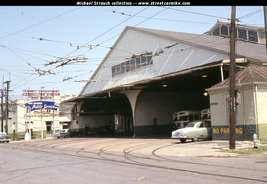
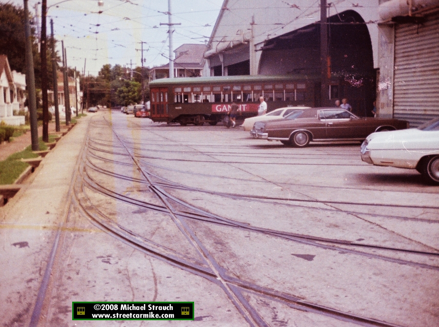
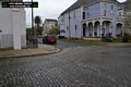
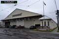
CARROLLTON STATION:
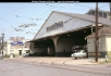 The official NOPSI label for each of its operating car barns or bus garages was "station." Here is the Willow Street side of
Carrollton Station on August 17, 1962. To the left of the barn is a sign with the classic Public Service paint
swash or lightning bolt (your choice) that identifies the division. Behind the sign is Carrollton Shops, where
streetcar rebuilding was performed. Inside the barn we see a Perley Thomas streetcar (possibly number 951) on the left side
and several St. Louis trolley coaches for the Tulane line on the right. Twin wires come out from the barn into
Willow. One photo from a slide in my collection added 12/11/11.
The official NOPSI label for each of its operating car barns or bus garages was "station." Here is the Willow Street side of
Carrollton Station on August 17, 1962. To the left of the barn is a sign with the classic Public Service paint
swash or lightning bolt (your choice) that identifies the division. Behind the sign is Carrollton Shops, where
streetcar rebuilding was performed. Inside the barn we see a Perley Thomas streetcar (possibly number 951) on the left side
and several St. Louis trolley coaches for the Tulane line on the right. Twin wires come out from the barn into
Willow. One photo from a slide in my collection added 12/11/11.
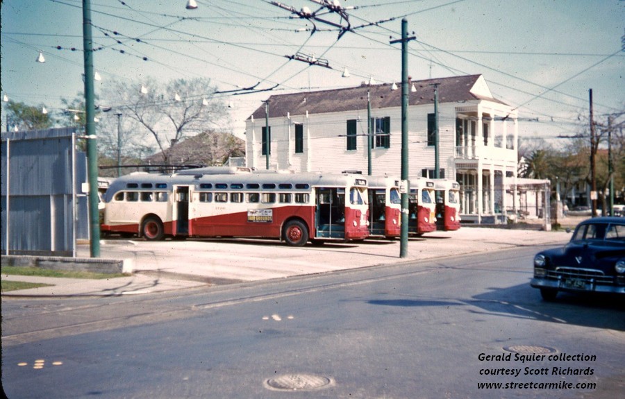
 Little known is the separate trolley coach yard at the lakeside-downtown corner of Willow and Dublin. NOPSI created this facility to hold the
Tulane coaches. Here is a shot from the Gerald Squier collection (courtesy Scott Richards). When Tulane was converted to diesel buses
in 1964, this became an electric substation, which use it has to this day. One photo added 10/17/14.
Little known is the separate trolley coach yard at the lakeside-downtown corner of Willow and Dublin. NOPSI created this facility to hold the
Tulane coaches. Here is a shot from the Gerald Squier collection (courtesy Scott Richards). When Tulane was converted to diesel buses
in 1964, this became an electric substation, which use it has to this day. One photo added 10/17/14.

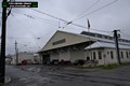

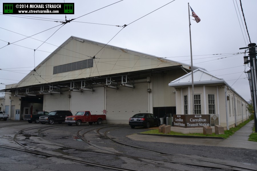
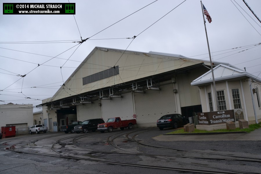
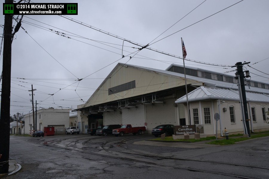
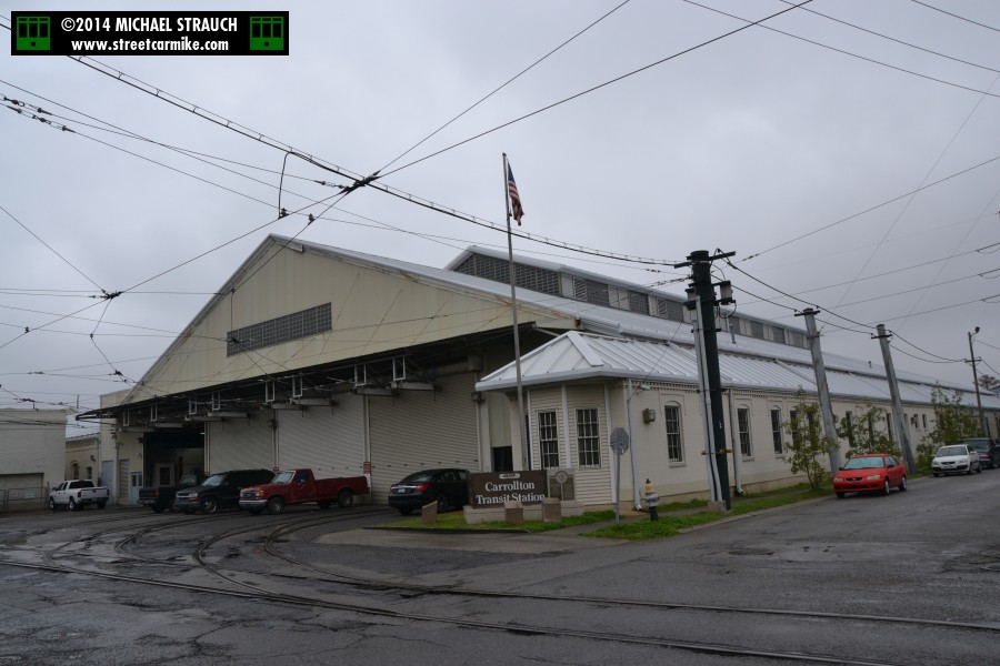
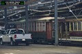
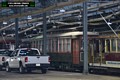
Carrollton Station under RTA ownership on March 6, 2014. Because the St. Charles line is undergoing track construction
in sections, only one gate is open for storage of uptown segment streetcars (above Jefferson Ave.). Those serving
the lower section (below Louisiana Ave.) are housed at Randolph Station (Canal). Four photos added 03/12/14.
DUAL GAUGE STREETCAR TRACKS:

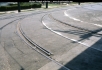


The St. Charles and Tulane Belt lines were originally standard gauge streetcar routes. NOPSI converted the belts to
wide gauge in October 1929. Dual gauge rails remained until 1931 to carry the cars of the South Claiborne Shuttle line
to storage at Carrollton Station.
Remnants of these dual gauge rails remained on Jeannette Street leading into the barn and on Willow Street
from Dublin St. to Carrollton Ave. until the 1990 rebuild of St. Charles trackage.
The first two photos (Willow St. and Jeannette St. sides of the barn, respectively) come from slides in my collection taken August 17, 1962.
The third and fourth photos (both Jeannette St. at Carrollton and at the barn, respectively)
were taken by me in the early 1980s. Photos 3 and 4 added 12/11/08, photos 1 and 2 added 12/11/11.
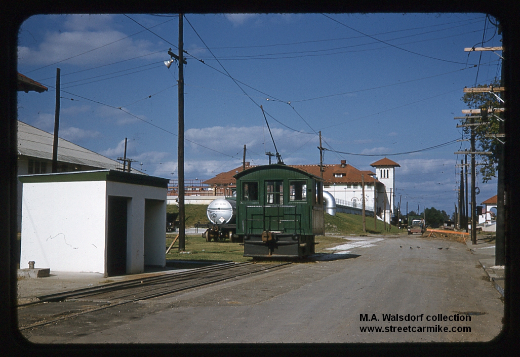
SEWERAGE & WATER BOARD:
 The New Orleans Sewerage & Water Board had a short electric line from the riverfront railroads to its plant on South Claiborne Ave.
during the 20th century (1908-1959). The single-track route ran along Eagle Street.
Here we see one of the box motors (no. 65, built by General Electric 1910 for the Mississippi & Gulf Coast Traction Co.)
parked within the facility in a 1950 slide from the collection of Mike Walsdorf (used with permission).
One photo added 09/11/13.
The New Orleans Sewerage & Water Board had a short electric line from the riverfront railroads to its plant on South Claiborne Ave.
during the 20th century (1908-1959). The single-track route ran along Eagle Street.
Here we see one of the box motors (no. 65, built by General Electric 1910 for the Mississippi & Gulf Coast Traction Co.)
parked within the facility in a 1950 slide from the collection of Mike Walsdorf (used with permission).
One photo added 09/11/13.
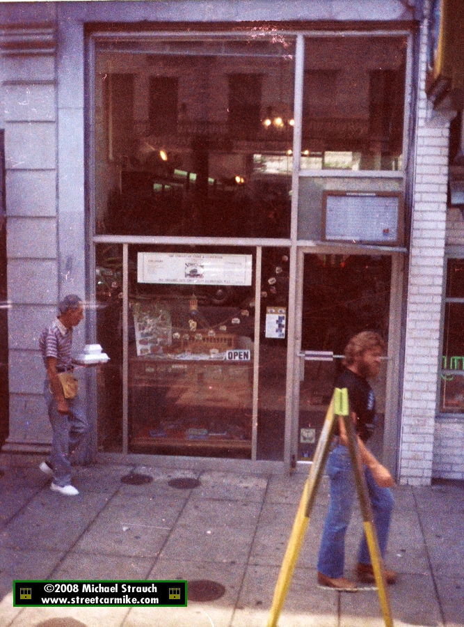
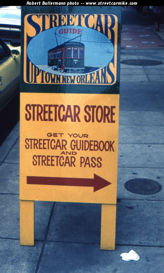
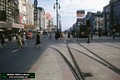
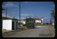
THE STREETCAR STORE:

 An early 1980s effort to promote the historic value of the trolley, The Streetcar Store
was located in the first block of St. Charles off Canal. Potential riders could purchase a day pass that
was honored for unlimited rides on the streetcar. The companion "Streetcar Guide to Uptown
New Orleans" enumerated the car stops (which was added to the signage) and described the points of
interest one could explore in the uptown neighborhoods. The Times-Picayune
featured the store in a news article. This is the first instance I know of anyone getting the Public
Service to join a cooperative effort concerning streetcars. Earl Hampton, Jr. has completed
a revised version of the guide for Pelican Press. The picture of the store was taken by me from
car 905 in August 1981. The picture of the sidewalk sign depicting the cover of the Streetcar Guide was taken
by Robert Bullermann on September 15, 1981 and comes from a slide in my collection.
First photo added 12/11/08 and second 12/11/11.
An early 1980s effort to promote the historic value of the trolley, The Streetcar Store
was located in the first block of St. Charles off Canal. Potential riders could purchase a day pass that
was honored for unlimited rides on the streetcar. The companion "Streetcar Guide to Uptown
New Orleans" enumerated the car stops (which was added to the signage) and described the points of
interest one could explore in the uptown neighborhoods. The Times-Picayune
featured the store in a news article. This is the first instance I know of anyone getting the Public
Service to join a cooperative effort concerning streetcars. Earl Hampton, Jr. has completed
a revised version of the guide for Pelican Press. The picture of the store was taken by me from
car 905 in August 1981. The picture of the sidewalk sign depicting the cover of the Streetcar Guide was taken
by Robert Bullermann on September 15, 1981 and comes from a slide in my collection.
First photo added 12/11/08 and second 12/11/11.
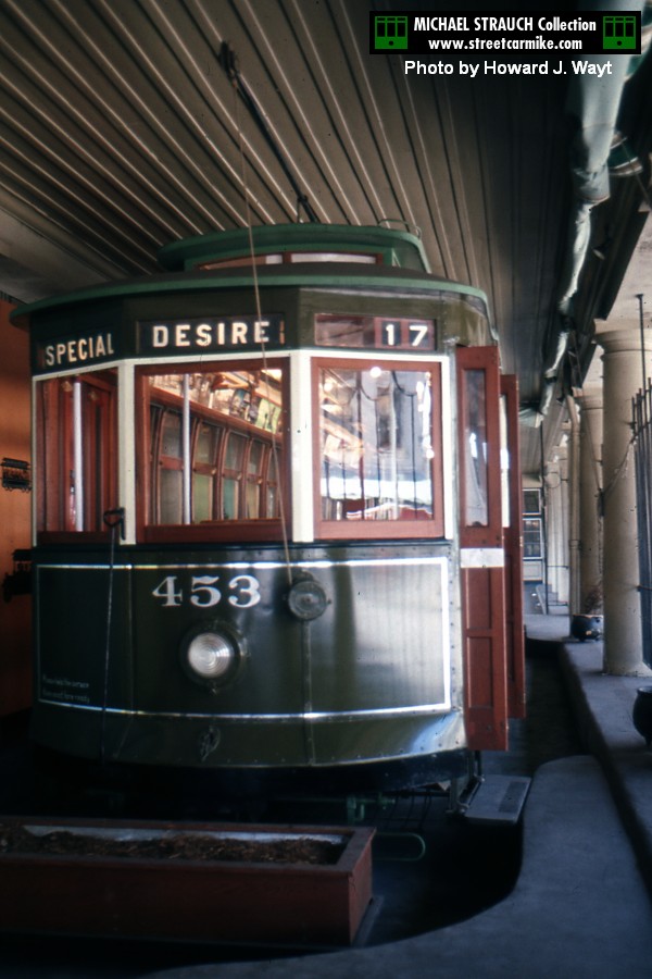
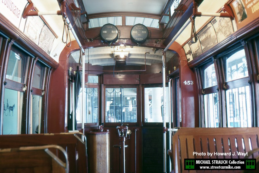
AMERICAN CAR Co. STREETCAR No. 453:
Please visit New Orleans Car 453 coauthored by Earl W. Hampton, Jr.
and H. George Friedman, Jr. for the complete history of this streetcar. Essentially, 453 became a stationary training car in the 1950s
and converted to a tourism office in the French Quarter in the 1960s. During the seventies, the car was removed from protective cover and neglected.
It was not until the 1990s that RTA moved the car from outdoor storage at the Old Mint to Carrollton Station. There are no current plans to restore it.

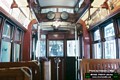 Car 453 in its original tourist configuration under cover at the French Market in two shots by Howard J. Wayt
taken in May 1969. Two photos added 12/26/14.
Car 453 in its original tourist configuration under cover at the French Market in two shots by Howard J. Wayt
taken in May 1969. Two photos added 12/26/14.
 Car 453 inside Carrollton Station on March 6, 2014. Two photos added 03/12/14.
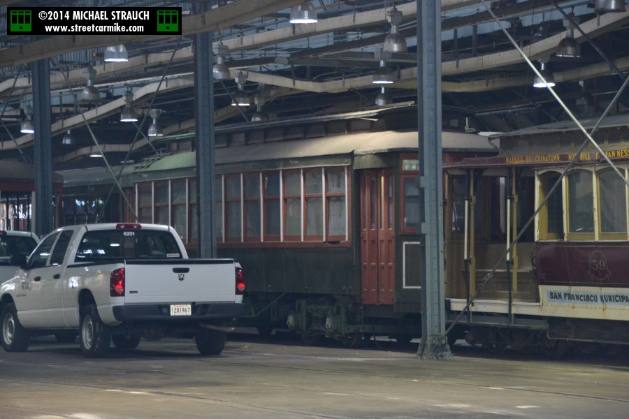
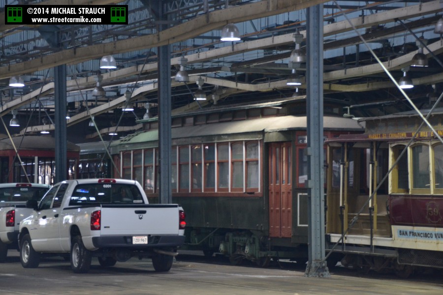
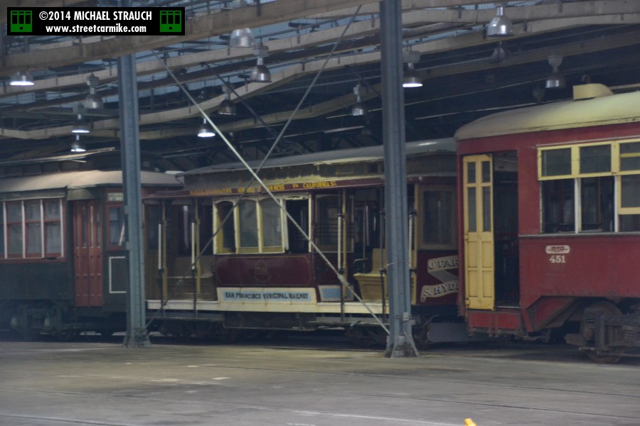
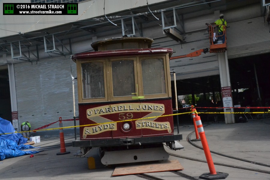
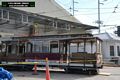
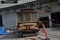
CALIFORNIA ST. CABLE RAILROAD No. 59:
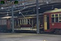
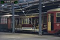 This artifact was a trade between New Orleans RTA and the San Francisco Municipal Railway. Muni, who got the better of the deal,
received Perley Thomas car 952, ex-Riverfront car 456 fully restored by RTA to operating condition and then-current logo.
New Orleans got California Street Cable Railroad car 59, built in 1907 by Hammond, which went on static display at City Park. The elements and termites got to number
59, and RTA eventually brought it into Carrollton Station, as seen on March 6, 2014. There is no way this car could be operated
in New Orleans because of the gauge and propulsion system. By the way, Muni built a new number 59 that entered service 1998, the year of the trade.
The running board says "Market St. Chinatown Nob Hill & Van Ness via California St.", but the end is decorated as "O'Farrell Jones & Hyde Sts."
Two photos added 03/12/14.
This artifact was a trade between New Orleans RTA and the San Francisco Municipal Railway. Muni, who got the better of the deal,
received Perley Thomas car 952, ex-Riverfront car 456 fully restored by RTA to operating condition and then-current logo.
New Orleans got California Street Cable Railroad car 59, built in 1907 by Hammond, which went on static display at City Park. The elements and termites got to number
59, and RTA eventually brought it into Carrollton Station, as seen on March 6, 2014. There is no way this car could be operated
in New Orleans because of the gauge and propulsion system. By the way, Muni built a new number 59 that entered service 1998, the year of the trade.
The running board says "Market St. Chinatown Nob Hill & Van Ness via California St.", but the end is decorated as "O'Farrell Jones & Hyde Sts."
Two photos added 03/12/14.
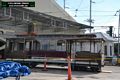
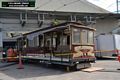
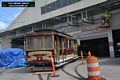
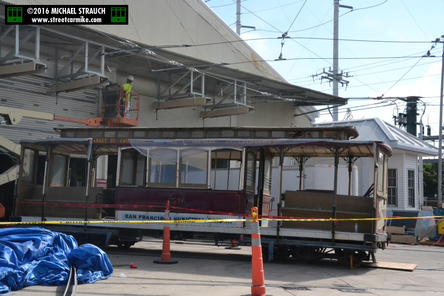
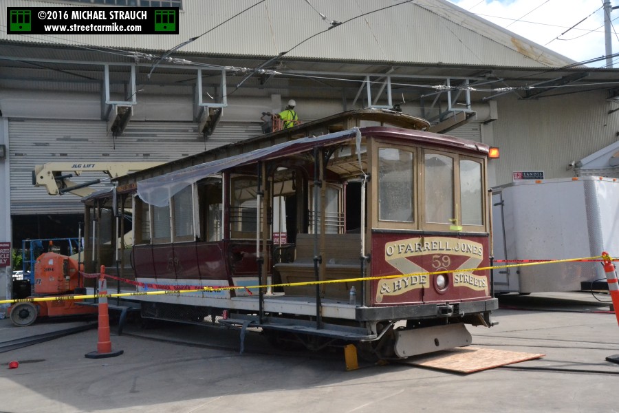
Construction at Carrollton Station occasioned the appearance of car 59 outside the Willow St. side on October 5, 2016.
Five photos added 10/21/16.
|